
0 miles
Its starts as always with the shitty part; the preparations. Buying food, organizing, packing, reading maps, thinking. Everything has its own place in the Oto, and for each trip equipment has to be piled together in different ways. Being on the road for a while now, I get the hang of it more and more, and this time preparations take only one day. Not bad. One more thing to do, I drive to the Island in the Sky and check out the land from above, that’s where I will be soon.

120 miles
The real trip starts off with a big discussion with the park ranger in Green River state park. Why do I need to bring a fire pan (something I don’t wane buy or even fits inside my kayak) if I don’t make a fire. I do carry already an extra life jacket (no idea why, wearing one is not mandatory) and even more annoying a throw rope (to rescue myself?). I do win the discussion but am now in a very against-America-mode. I paddle hard to get it out of my system and think happy thoughts about what is in front of me; 120 miles of the Green River, snaking through the center part of the Colorado Plateau.
Over time, southeast Utah was flooded by oceans, crisscrossed by rivers, covered by mudflats and buried by sand. The climate has resembled a tropical coast, an interior desert, and everything in between. Layer upon layer of sedimentary rock formed as buried materials were cemented by precipitates in ground water.
Until about 15 million years ago, most of the Canyonlands area was near sea level. But movements in the earth's crust caused the whole area to rise. This uplift is known as the Colorado Plateau and today the average elevation is over 1700 meter above sea level.
Erosion instead of deposits is forming the landscape nowadays and the Colorado and the Green river are cutting canyons deep through all the deposit layers. Following the Green river south, I make a trip back in time. Every mile I paddle brings me deeper into the earth and older layers are exposed.
I start in the Dakota sandstone, deposited about 100 million years ago.
 And among other layers, I paddle down into the Nevajo Sandstone, 175 million years old.
 The White Rim sandstone, 250 million years old.
 As far down as the Paradox formation, 300 million years old.
 Over the course of the 6 days I am on the river, I travel through 25 different layers. Its amazing to see these layers being born right in front of my eyes.
 Had I came for solitude, the opposite I get. As floating in a sea kayak is not really comfortable, I make way better progress then all the canoes. And I get to know the other people on the river and word spreads around about me.
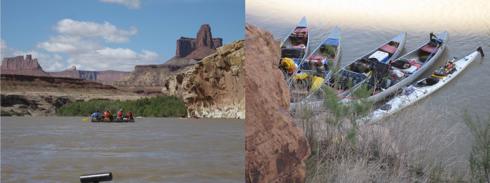 And that’s not a bad thing, because I become “the woman who likes to be alone” and get some solitude. With very high water there are not many campsites and I still have to share twice a campsite. However the nights that I spend alone are making more then up for it.
  With easily 30 miles days (with 4 miles/hour for free) I have to temper myself not to be to early at the end. I force myself for some side hiking exploration. A good one is Bow Knot Bend, where the river comes within 600 meters back to itself after running for 7 miles around a bend.
  In Jasper canyon some 5.7 climbing moves brings me in a desolated canyon.
 I climb up from Fort Bottom, where I camp, to some ruins and admire the towering cliffs around me.
 But also from the river the cliffs are amazing.
 With a good view from below to candlestick tower.
50 miles
I am at the confluence, 700 meters below the surface of the earth, where the Green River and the Colorado River come together. Ahead is the Catarac canyon, a white water stretch, with rapids up to class V. That’s a literally dead end canyon for me. I make camp with 6 older guys from Salt Lake and get filled up with food, beer, stories and wait. The next morning there is breakfast and I keep waiting. At the agreed time they show up, my jetboat ride back up the Colorado to Moab.
 It’s a whole different feel to cruise on high speed to this red country and I am not into it anymore and mostly talk with the other passengers.
 51 miles
Back in Moab things are not over yet. A waiting is my bike and so I repack for a ride back to the Oto. The first 16 miles are on the main road and it is not a pleasant ride. I quickly head west for a dirt road short cut, which of course turns out to be longer then the main road. I make camp, well, I throw down my sleeping bag behind a bush. Being bitten all over, this night the no-see-ums are not getting me, and I sweat through the night in my bivi sack.
 When I mount my bike the next morning I feel complete happiness. The sun is out, the wind in my back and no other person to be seen. I might call myself, a climber, a hiker, maybe even now a kayaker, but what I really am is a biker.
  With the road stretching out before me, waiting to be discovered, this is what I love, this is who I am.
Iris (Green River, 39237 miles)
