30 June 2009

9449 - Monthly June update


View IrisOpReis in a larger map

Dag,
   Iris (Anchorage, 9449 miles)

24 June 2009

9360 - Hatchers pass


It took me more then two weeks to drive north to check out the pipeline. Two weeks of hardly any exercise, two weeks of sitting in the Oto. And now I am back in Anchorage and I feel I have to get out and the most obvious choice is to go hiking at Hatcher pass north of Palmer.


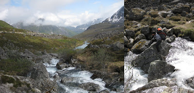
Merely having any endorphin addiction left in my body, its 17:30 before I leave the parking lot. Instantly I feel the relieve of moving again. The sun is out, the rain is out, making a mosaic of light along the valley walls. With many more hours of sunlight and only 8 miles of walking to my destination, the Mint Glacier hut, I take my time. Its not totally clear where the cabin is located at the end of the valley, but I have put the coordinates in my GPS at home. The last 800 meters go uphill, and when I arrive on top of a little ramp after 400 meters, there is no hut in sight. I check the GPS again, 400 meters in front of me there should be a hut, and with 23:00 on the clock it would be nice to see it. But in front of me is just a solid granite wall and no hut. I check my GPS again, 400 meters + ah I get it, 500 meters of altitude gain. Looking around I see the trail snaking its way up far to the left on the valley wall. I am not totally sure where I will find the strength to do that, but at least I can give it a try. I am tired and my backpack is way to heavy and every 5 minutes I need a break.


Its time to give up and pitch up my tent, but hold on; Bear tracks in the snow, my hand glides automatically towards my bear spray, its still there. Pitching up a tent now, would mean cooking outside away from the tent and in the rain, not something I am up for right now. I drag myself further up the trail and finally at 1:00 I see the little red cabin perched high above the valley floor, 400 meters away but this time with 0 meters elevation difference. The cabin is very well equipped and I am the only one occupying it. I make soup, tea and some more tea and hit bed, right after that.


When I wake up, its already late and rain, snow and wind are trying to isolate my little red cabin from the world. I make a quick decision. I am going to spend the day here, making jigsaw puzzles and enjoying my time alone. Its nice to live high up in the mountains all alone, who needs meditation when you can have this.


In the evening beaten down by the weather, A and her daughter H are joining me. Coming from red-neck Wasilla (Sarah Palins home town), but obviously being the opposite herself, A is a very interesting woman to talk to. Its late when we finally make it into bed. The snow keeps falling the whole night, and we wake up with 10 cm fresh snow in the morning.

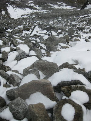
My original plan was to do a 3 day loop and with a glance on the map, I decide I can still continue the route. During packing my much lighter backpack most of the snow is melting away. I start scrambling up the boulder field leading to the pass with fresh legs and a fresh mind. The boulders are pretty big, and the higher I come the more slippery they get. Its getting a bit tricky to move forwards. Near the pass more snow is covering the ground and I have to use all my concentration to keep myself from falling. After 2 hrs of hard work I am at the top and see a huge snow field in front of me. The idea is to traverse the field before dropping down over the next pass. Its looks easy and with a smile on my face, I pull out my gamaschen, an extra layer of clothes and my tracking poles. It takes only one step into the snow to changes the smile into a grim. I am post-holing until my hips into the snow. I try two more steps, with the same result. This is so not going to work. I turn around and try to make it back to the pass. This is however not obvious and I become a little scared. Is it possible to sink even more into the snow? It might be really thick, I might not make it back to the pass. I take a moment to rest and think. Spreading of weight and using my trekking poles for leverage should do the trick. With all my strength I drag myself back to the pass. There is no way I am going to make it trough this snow field, my only option is to turn around and head back. With a cold wind blowing over the pass, I start scrambling down immediately. Ahead of me are 7 hrs of hiking back to the Oto, something not to think of at this moment.


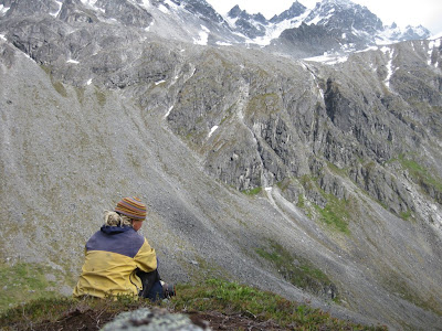
Scrambling down is even worse then scrambling up snow covered boulders, and it takes it all out of me. Near the bottom of the valley I sit down for the first time, and take a moment to relax and eat. I better enjoy this hike back through the valley, otherwise its will become a long drag. And so my eyes wonder along the slopes looking for the white dots indicating mountain sheep. I stop to look at all the wild flowers along the trail.


I sing, I tell stories to myself, I spend some time watching the beavers fortifying their dam. After 9 hrs of hiking I hitch hike back to the Oto, which is parked up the road. Its 21:00 and that gives me only one hour to make the drive to Sutton. With only 3 minutes left, I ran to the podium to be just in time to see my friends from Fairbanks playing at the Granite Creek Bluegrass festival. I am tired and my legs are sore, but with good music I can always dance. And that is what I do for the rest of the weekend.

Dag,
   Iris (Hatcher pass, 9360 miles)

20 June 2009

8890 - Development? Technology? Nature!


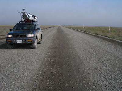
84 miles north of Fairbanks the Dalton highway starts, also called the Haul road, made for truckers hauling equipment to the North Slopes. With almost no services along its 414 miles stretch, and mostly consisting out of gravel, it’s a little bit intimidating for me. It however never leaves the pipeline out of sight and its the only way north, and that is where I wanna go.


The road starts with mile 0, in the Boreal forest which circles the northern hemisphere and by doing so making it the largest ecosystem in the world.


Wild fires, feeding the new cycle of life, and the depth of the permafrost dedicate this landscape. On north slopes with less sun, the permafrost will be closer to the surface, providing less soil for vegetation. South slopes and rivers valleys do the opposite, they providing more soil. Its makes a very diverse landscape and interesting to travel through.


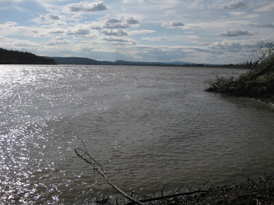
At mile 56 I cross the mighty Yukon river, 3200 km long and the natural highway for centuries. There are almost no access points to the Yukon and I am impressed to see it here. I top off my tank and help some mosquitoes to their next life. The next gas station is in 123 miles and then there are 240 miles without any.

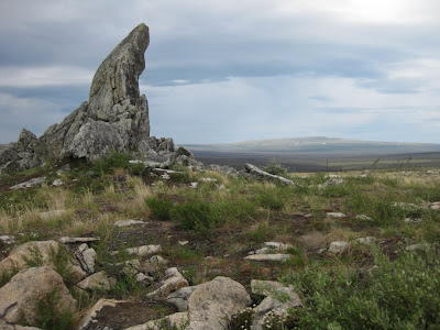
The road climbs slowly up to Finger mountain at mile 98. And with the trees left below me the views are immense.


I walk around and boulder a little bit on Finger rock. In the mean time enjoying the breeze who keeps all the mosquitoes away.

At mile 115 I cross the Arctic Circle and with solstice around the corner, the sun doesn’t do her thing anymore. She just rotates around my head with no indication of time or direction anymore. Its confusing and late at night, or early morning, or what ever time it is that people are suppose to sleep, I am laying in bed reading a book.


The road continues and starts climbing into the Brook Range. There are only a few actual glaciers left here, but its obvious the landscape was once formed by them. Wide U-shape valleys are opening up to me and dramatic views of the mountain range are changing after every corner I take. I love this country, this is nature in its best.
At mile 244 I reach the Atigun pass (1422m) and start descending towards the North Slope.
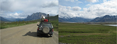

Mile 275 and I pop-out of the Brook Range and see the wide slowly downwards tilted roles of the North Slope. There is still no oil fields in sight, just wetlands all around me.
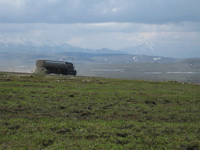

This high north the permafrost is just below the surface and only tough, ground-hugging plants can survive the frozen ground, frigid temperatures, icy winds and weak sunlight. This country is empty, except from the pipeline and the road, there is no indication of any civilization. If I would head east or west for hundreds of miles I would not see any human. This is wild country, the way it supposes to be.
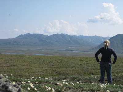

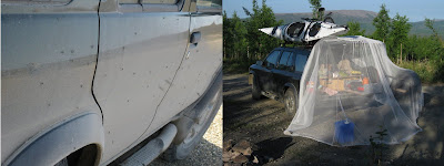
The low precipitation here would not explain all these wetlands around me, but the permafrost does. Water simply does not drain into the sealed ground and creates mosquito heaven, people’s hell.

The land flattens out at mile 355 and the Coastal Plane lays in front of me, I feel home.

Well, except for lack of church towers in the distance indicating a little village and the muskoxen and caribous I stumble upon are also not real familiar.
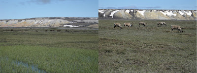

Its amazing to see all this wildlife from up close. All kind of birds flying over feasting on all the mosquitoes, mosquitoes flying over feasting on me. But this last part kind of doesn’t matter, because there is so much to see, to feel, to enjoy.

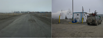
And then I finally reach the industrial camp that supports the Prudhoe Bay oilfields at mile 414, Deadhorse. Its foggy, cold, people live in containers and I can see oil pumps all around me. There is no place for nature here. The “town” has a wrong feeling to it, the mostly man, living here are working and time to play will have to wait until they return to their villages, to their family. I fill up my tank straight from “the source” and turn the nose of the car towards the road I came from. 240 miles to the last gas station, 414 miles to the beginning of the road, 500 miles to Fairbanks. And with the knowledge I am going to see all of it again. It feels good.

Nature or Development, I still don’t know.
It will be hypocritical for me, traveling by car instead of my bike, to say gas is not needed. The pipeline and its haul road gave me the opportunity to see this part of the country. It will be unfair to say to all these people trying to make a living in Alaska by working at the North Slope, go home. And I rather have the USA providing its own gas, instead of fighting a war over it in Iraq.

On the other hand, what about the oil spills, do we really know the impact of all this development in such a delicate environment, what are the long term effect? I strongly believe we should look for alternative resources to fulfill our addiction. We have to save some pristine nature in this world, we have to decrease our impact on this planet. We have to do a better job then we do now.
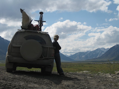

As far as the North Slope, it’s the balance between Nature and Development, and I do not know how the scale reads in this case. I simply don’t know.

Dag,
   Iris (Fairbanks, 8890 miles)

13 June 2009

7797 - Nature? Development! Technology!


In 1968 oil was found in the Prudhoe Bay area, lots of oil, 25 billion barrels, making it the largest discovery in the USA and the 18th largest field in the world. Besides the challenge how to pump it out of the ground, another challenge was how to transport it out of Alaska to the lower 48. With the Prudhoe oil fields (locally known as “the North Slope”) located on the Arctic Ocean, shipping it straight out was not the most obvious choice. The plan was developed to build a pipeline to the ice free port of Valdez, 1286 km to the south, at the Prince William Sound.
After major opposition from conservationists and Alaska Native groups, the Alaska Native Claims Settlement Act (1971) calmed everybody down. There was land set aside for the Natives, for National Parks and Reserves, for oil exploitation and for the pipe line.
And in 1973 the oil companies with exploration rights (BP, ExxonMobile, ConocoPhillips) forming the Alyeska Pipeline Service Company started to design and build the pipeline.

And so the technical challenge started.

Mountain ranges
The problem: How to transport the oil through the pipeline as it is crossing 3 big mountain ranges, the Brook range in the far north, the Alaska Range with Denali as its highest point in the middle, and the Chugach mountains with all its glaciers in the south.
The solution: 11 pump stations are spread along the length of the pipe line to slow down or speed up the oil flow through the mountains.


Permafrost
The problem: From north of the Chugach range to more or less the Arctic Circle, the ground consist of discontinuous permafrost and further north there is even continuous permafrost. Burying the pipeline which transport 50C oil would melt the permafrost causes the pipeline to sink.
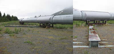
The solution: The pipeline is elevated above ground. Where the pipeline must be buried to cross a road, the line is situated in an active refrigerated ditch.
But the problem continues, the vertical beams holding up the pipeline can even melt the permafrost, and are therefore equipped with an ammonia based heat pipe inside and a heat exchanger on top.


Temperatures
The problem: With temperatures ranges from -40C to 25C the thermal expansion of the pipeline is a big concern.
The solution: Placing the pipeline on shoes and laying out a zig-zag path allows horizontal and lateral movement.


Denali Fault line
The problem: The line crosses the unstable Denali Fault line.
The solution: Place the pipeline on long sliders.


With all technical challenges covered, the pipeline started operating in 1977 and Alaska had a new source of income, oil instead of gold.
Project closed.

I love all this technical nerdy stuff and spend hrs reading all the information displays along the road, but what about the environment? Do we not all remember the ExxonValdez oil spill in 1989, when 40 million liters of oil were spilled in the beautiful Prince William Sound. Shouldn’t we all protect the wildest part of the wildest state? Its time to check it out myself, I am heading north.


Dag,
   Iris (Fairbanks, 7797 miles)

08 June 2009

7013 - He does it again


Its weekend and time to play. This time V takes us out to Hatcher pass, to climb, to trad climb on granite to be more precise. A shows us the moves on lead, before he races back to town.


Then it’s our turn. My left arm is far from recovered and I hand over my lead to V. Its only 3 pitches but it takes us a couple hours, while we are just sitting at the belays taking in the surrounding. I love this treeless country with no other then a good person around. This is total happiness.


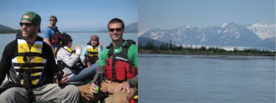
But as it is with V, the good life is not over yet, he takes us out on the Knik river the next day. V is the captain, bro A is second in command and I am the navigator in front of the boat, but it feels we need more people. T is called to become our cook, M is asked for the good stuff and their friend C comes along as our client. Now it feels more complete and off we go.


From the map it looks like an interesting river with a glacier at the end of the valley. It takes us a while to leave the ATVs running in the gravel bars besides the river, and the houses and anglers on shore behind. But then we can relax and focus our view on the glacier showing itself at the end of the valley.


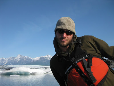
None of us really has any idea where we are going and we decide to go as near to the glacier as we can get. The closer we come the colder it gets and we see icebergs floating in the river. We still have no clue what is ahead of us. When we turn the last bend, we suddenly see the Knik glacier in full view in front of us. Its massive, real massive. The Knik is fed by 2 icefalls in the distance which have deposit their side moraines on top of the glacier and from the right the Colony glacier joins, filling the whole valley in front of us with ice. Ice as far as we can see, ice e erywhere. With high temperatures the last couple of weeks the end lake is filled with icebergs calved from the glacier front. The view is to much to comprehend and its good that we brought food so we can sit here for a while. T is putting an amazing meal together with veggies, scallops and salmon and we enjoy life to the full extend.


After hours trying to take this all in, there comes a time to head home. But not before we cruise along the icebergs with the boat.


V did it again, it was an amazing weekend. Thanks and all loves to you.


Dag,
   Iris (Anchorage, 7013 miles)

02 June 2009

6933 - Prince William Sound


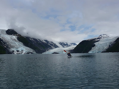
They are three Italian men, I am one Dutch woman, the deal is quickly made. We will go on a sea kayak trip on the Prince William Sound together. Its safer to go with a group than alone, which was my first plan, but these guys are maybe too hardcore for me, Seven summits, mountain guides.... They acclimated and topped out on the normal route of Denali, but had to come down before they could even try the Cassin Ridge due to bad weather forecast. Now the plan is to do a 5 day trip, 120km in total, to Harriman Fjord and that is far, very far. Besides my kayak (yes, I am the proud owner of a kayak now), we take a single and a double with us. I like the idea of the double, because which woman is not dreaming of being paddled around by a singing Italian.

The first day all is good. The weather is sunny, the water is flat, the channel crossing goes smooth and we all enjoy the surrounding and the movement of the kayaks. We camp in a little cove and eat our food near the campfire.


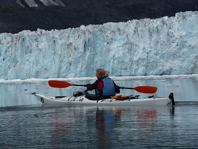
The next day, with more then 6 hrs of paddling in front of us, with wind and rain, I am glad I can start of in the double with F. We have a nice rhythm and sometimes have to wait for C and M. In the afternoon I switch back to my own kayak. It feels more natural, because the kayak is lower and less wide, and my strokes come out better. I can easily keep up with the double, but when we arrive at camp I can feel the day of work behind me. This is however Alaska and hard work always gets rewarded. We camp right below Cox glacier, Cascade glacier is just across the bay, and the Barry tidewater glacier is to our right.


The whole night we hear the glaciers cracking and ice falling into the water from the Barry glacier. We wake up with big pieces of ice on the beach left behind by the tide.


When the sun breaks through the clouds, we hit the water and paddle through seals and pieces of ice. This is to unreal to be true.


With many many kilometers ahead of us for the way back, we have to keep moving. I feel sad to leave all this behind and I am also getting more and more tired. The guys have to wait here and there for me.


Luckily we can inhabit a cabin in the night and I prepare my own food on the wood stove. I wake up tired and my tolerance to loud Italians is a bit down. As I pack my kayak alone, I suddenly see a bear popping out of the woods just on the other side of the little channel from me. My first bear in Alaska!

This and the sun will make my day as we have to paddle far. Nevertheless in the afternoon when the wind picks up again there is not much to keep me happy. Also this night I have to prepare my own food, and my mood goes down to a low point. Only so far for the Italian men.

The next day I am however offered the double. And with a strong paddling F in the back (these guys are hardcore and keep going) the way back goes smooth and quick. My happy me comes back again, we try how fast we can get the double and I start smiling and liking them again.


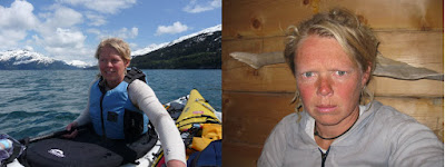
Even so its good to see the Oto again because my face has changed in these 5 days. I am salty, tired, my wrist is developing tendonitis and I live for sure on a different wave length then these guys. I drive back alone. Its good to be home again with V and A, real Alaskan men.

Dag,
   Iris (Whittier, 6933 miles)