Iris (Chromo, 41843 miles)


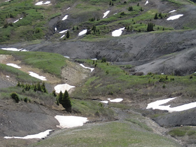
 The next morning its time to pack my stuff, dig out my panniers, mount my front rack on the bike, change pedals, boil the last eggs, drink the last milk and at 10:00 hit the road. The first challenge is also immediately the biggest one. Indiana pass with 3630 meter the high point of my trip. The route climbs through a natural contaminated area, with all the water carrying toxic metals and abandoned mines all over. I have to ration my water intake, but still run out of it after a while.
  Whoosh! What was that. Another biker with hardly any gear comes down the road. There is no time to stop, an hellooo is all I get. I have heard that the Self supporting GDMBR race is on the way and in the area. Would this be one of them? My thought are going to my left rear pannier. This morning when I finished all the food in my cooler there was one item I decided to just take. A water melon. So here I am encountering these light weight bikers, and me, I carry a heavy water melon over the highest pass on the route. I should have listen to W, who shove me a light weight backpacking know-how book under my nose last week.
  On the downhill I find an amazing camping spot. Out of sight, a stone fire ring with wood, a grassy field for my tent and a magnificent view. Oh damm, I have no water. I am so used that Oto carries everything I need, that I hadn't give it a second thought. So I mount my bike again and descent more. Two more bikers with hardly any gear are coming up the road. They have time to stop and tell me that indeed they are doing the GDMBR as a race. They are talking about 100 to 160 mile days, hardly any gear and around 20 days for the whole route. They are insane! The guy I passed this morning is from French and is riding a single speed. Hmmm, insane or just fucking cool.
 Also today I have to climb a pass, Carnero Pass with 3100 meter of altitude another hard day. This time however I take water just after the high point and can camp when ever I feel for it. It only takes me a while to hang my bags high up in a tree, for the rest its a perfect spot.
 When the sun comes up, I wake up and after some coffee and pancake breakfast another long day is waiting for me. This time Cochetopa pass, 3050 meter, is on route. With more racers and more irissen around, I never feel alone and love the ride and have no worries.
  Its late in the evening and again I am looking for water. The map indicates a river crossing, but when I arrive I know when cows are not my best friends.
  Its goes up and down again and the road is filled with the so hated washboard.
  Finally I arrive in Doyleville, 3 houses and a haystack. I knock on the most organized house and X opens. Yes, I can get some water and yes I can pitch my tent in the garden. A couple minutes later we head instead to the Taylor river for some whitewater kayaking for X and shuttling the car for me.
  Well the next day I do feel it. And Marshall pass with 3300 meters in altitude is far, high and lots of suffering. From the top however its all downhill to Salida.
  I drop by the bike store and H invites me to take a shower at her house. From one comes the other and I spend a rest day riding on a cruiser bike around town. Salida, is one of these secret little gems with wonderful people and lots of outdoor activities. H is an hardcore single speed mountainbiker and I like her a lot. Until late at night we talk and it feels like friends from way back then.
 The road climbs steep out of Salida onto a high plain. Here and there are some second homes, but most of the area is empty, with hardly any other traffic.
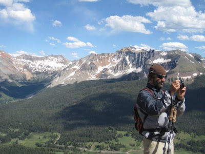
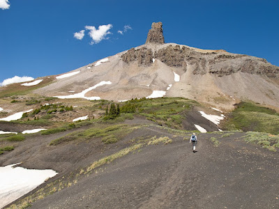
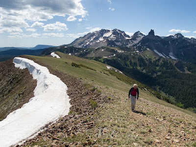
 The views to the west are immense. And several 4000 meter peaks are dotted along the Continental Divide.
  This is when you forget the numb hands, the sore bud, the pinched nerve in your shoulder. This is why you do it for. The feel to live on top of the world.
  The last day I continue in the wide open plains before arriving in Como.
  Almost every day I had rain, hail and thunder in the early afternoon and sometimes I had to pitch up my tent again to wait out the worst. This time I drink coffee in the post office lobby with B, who is also biking around and of course knows W and H. This Colorado outdoor world is so small. When the sun is back one more last pass is waiting for me. Boreas pass, 3500 meters, but with a gradual climb not bad at all.
 The other side of the pass drops me into Breckenridge, with the 4th of July weekend a place not to be. I continue on a busy bike path along a busy highway to Frisco and the same is true here. I hide myself in the woods for the night, the last 10 miles to Silverthorn are not for me.


 High dune with 198 meter of height is one of the tallest dunes and a good burley 1 step forward ½ a step slide down hike up. The sun is hot, the sand even hotter.
  When I run back down the slopes, sand is piling up in my shoes and burning my feet. Stopping is no option, while now I am sinking to my ankles in the hot sand. Did it take me an hr to hike up, 20 minutes is all it takes to bring me back to the Oto.
 We dance at the Telluride bluegrass festival, drink beer, cook, read, talk, bike and hike.



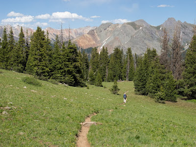

 When floating down the Green river a couple weeks ago, I cut down through about 25 of the upper layers, deposited between 100 and 300 million years ago. 40 of the lower layers, deposited between 200 and 2000 million years ago, I saw when descending into the Grand Canyon last year. Now, by touring around the Colorado Plateau in my own Tour de Colorado Plateau, I focus on almost each layer individual. The question is just how to avoid all the other tourists. A couple emails help out.
 Known for its giant natural amphitheater filled with hoodoos, formed by wind, water and ice erosion of the river and lake bed sedimentary rocks.
  When rain combines with carbon dioxide forms a solution of carbonic acid the relatively soft limestone erodes easily away. It is this process of chemical weathering that rounds the edges of hoodoos and gives them their lumpy and bulging profiles. In the winter, melting snow seeps into cracks and joints and freezes at night. Over 200 of these freeze/thaw cycles occur each year in Bryce Canyon. Forming windows and hoodoos.
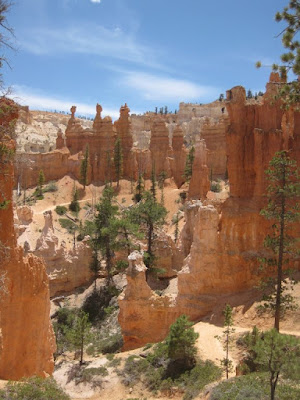 And thats beautiful from above and from below when I take a hike on the with only 1% of the actual amount but still a lot of tourist filled trails.
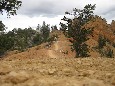
 With no suspension, helmet, gloves, stubby tires or much experience, its hard, scary but very rewarding and deserted.


 I take a nice stroll to a double arch, with only a few other tourists around.
 I take the partly dirt Burr trail, which cuts straight through Long Canyon in the Grand Staircase-Escalante NM, before entering Capitol Reef NP.
  When it pops out the views are until far and beyond and makes a very good camping spot.
 The email says: Lower Muley Twist, I have heard its good.
 Its hot and I take breaks in the shade.
 I don't see another person though and enjoy the canyon walls rising high above me.
 To get back to the other side of the Waterpocket Fold I don't have to climb it, but Muley Twist my way trough it.
 Its a long hole back to Oto to complete the 15 mile loop. Bugs and heat are my part.
  No complains though with a landscape like this around.
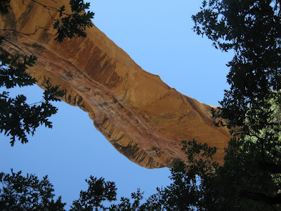 The email says: Where all the tourist go left, go right, up stream, there are some ancestral Puebloan cliff dwellings.

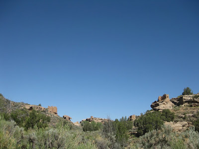
 Cliff Palace I see from the road.
